Logical consistency: The shapefile is converted to SDC (Smart Data Compression) format using either Esri SDC Data Development Kit Professional 2 (DDKP2) or tools in ArcGIS. The SDC data set is then loaded into ArcSDE® to verify and validate the geometry. Horizontal position accuracy: The geospatial part of this data set was extracted from the 2000 Census TIGER/Line® files. The positional accuracy of the TIGER/Line coordinates varies with the source materials used but at best meets the established National Map Accuracy standards (+/- 167 feet approximately) where 1:100,000-scale maps from the USGS are the source. The Census Bureau cannot specify the accuracy of feature updates added by its field staff or of features derived from the GBF/DIME-Files or other map sources. Thus, the level of positional accuracy in the TIGER/Line files is not suitable for high-precision measurement applications such as engineering problems, property transfers, or other uses that might require highly accurate measurements of the earth's surface. Other data details: After processing, the data set is checked for drawing display and number of records and file sizes compared with source materials.
Notes:
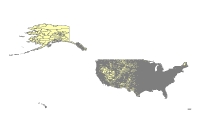
U.S. Census Block Groups provides boundaries and demographic information for the U.S. Census block groups within United States. The boundaries are consistent with the tract, county, and state data sets. Largest scale when displaying the data: 1:100,000. Publication date: 200701, 20070606; Ground condition: 2000. Vector digital data.
Local Notes:
For assistance ask at the 2nd floor service desk in Davis Library.