Logical consistency: No duplicate features are present. The shapefile is exported using Avenue request ExportClean. This request verifies and enforces the correctness of shapes. Horizontal position accuracy: The geospatial part of this data set was extracted from the 1990 Census Version TIGER/LineTM files (CD-ROM edition). The positional accuracy of the TIGER/Line coordinates varies with the source materials used but at best meets the established National Map Accuracy standards (+/- 167 feet approximately) where 1:100,000-scale maps from the USGS are the source. The Census Bureau cannot specify the accuracy of feature updates added by its field staff or of features derived from the GBF/DIME-Files or other map sources. Thus, the level of positional accuracy in the TIGER/Line files is not suitable for high-precision measurement applications such as engineering problems, property transfers, or other uses that might require highly accurate measurements of the earth's surface. Other data details: After processing, the data set is checked for drawing display and number of records and file sizes compared with source materials.
Notes:
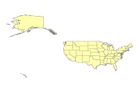
U.S. States (Detailed) provides detailed boundaries that are consistent with the tract and county (detailed) data sets and are effective at regional and state levels. Largest scale when displaying the data: 1:100,000. Publication date: 199901, 2000; ground condition: 1990, 1987. Vector digital data. Thumbnail.